Excursions
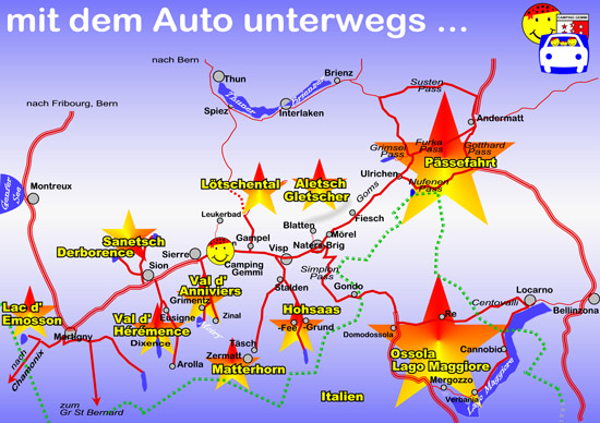
Om u een indruk te geven van de diversiteit van onze regio, geven wij u enkele aanbevelingen voor reizen met uw voertuig.
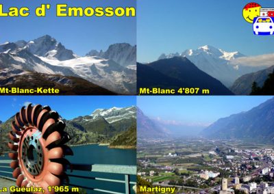
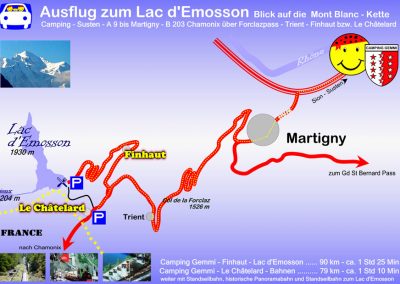
Lac d'Emosson with views of the Mt Blanc chain
The road from Martigny to Chamonix via the Forclaz Pass (1527 m) is one of the most beautiful in Switzerland. In long bends it rises to the pass and offers an exciting panorama. The excursion over Finhaut or by train from Le Châtelard to the Lac d ’Emosson is worthwhile. From the La Gueulex car park, above the dam of the lake, you have a wonderful view of Europe’s “summit meeting” with the Mt Blanc chain and the highest mountain in Europe at 4807 m.
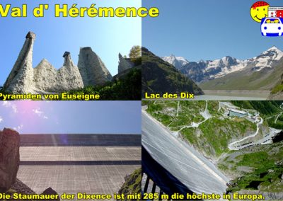
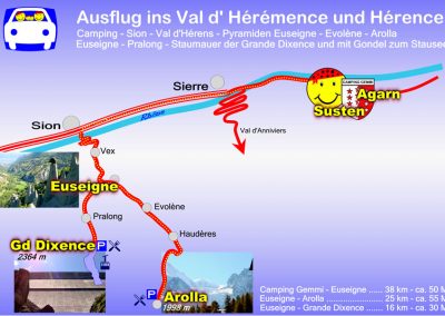
In the Val d’Hérémence
Vex, the gateway to the Val d ‘Hérens and Val d’Hérémence, is about 450 meters above Sion. The pyramids of Euseigne are five km after Vex. They were created by washing loose glacial moraine debris into bizarre shapes. Where stone slabs prevented regular erosion, pyramids remained under the cover slabs. In Vex you branch off to the Grande Dixence dam, which is 285 m high, and via Pralong you come to the parking lot at the foot of the dam. The top of the dam (2364 m) can be easily reached with the cable car.
Derborence and Sanetsch
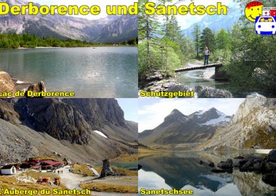
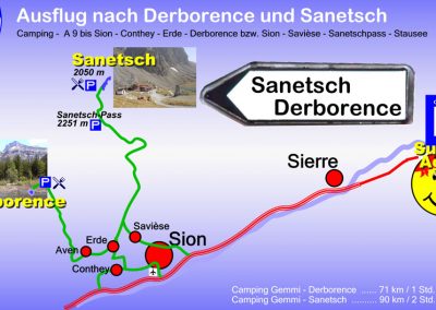
The landscape in the Derborence basin emerged after the devastating landslide of 1814. At that time a mountain lake was created, around which we now find a protected landscape and one of the few virgin forests in Switzerland. Through the valley of the Morge it goes to the Sanetsch pass (2242m) and further to the Sanetsch lake (2035m). The trip provides a magnificent view of the Valais and Bernese Alps. There is a popular mountain restaurant above Lake Sanetsch.
In the Val d' Anniviers
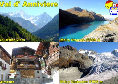
Vex, the gateway to the Val d ‘Hérens and Val d’Hérémence, is about 450 meters above Sion. The pyramids of Euseigne are five km after Vex. They were created by washing loose glacial moraine debris into bizarre shapes. Where stone slabs prevented regular erosion, pyramids remained under the cover slabs. In Vex you branch off to the Grande Dixence dam, which is 285 m high, and via Pralong you come to the parking lot at the foot of the dam. The top of the dam (2364 m) can be easily reached with the cable car.
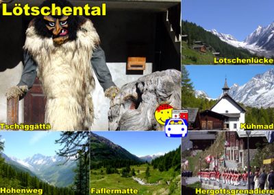
In the Lötschental
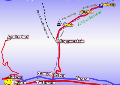
The approximately 18 km long Lötschental runs along the wild Lonza gorge from Ferden (1375 m) to the northwest over the Langgletscher to Lötschenlücke (3178 m), the transition to the Aletsch area. The autostrasse leads through Ferden, Kippel, Wiler and Blatten and ends at the large car park at Fafleralp (1788 m). The valley is framed by numerous majestic mountains and glaciers. Here you can follow well-developed paths such as The hike, which can be easily reached with the Wiler-Lauchernalp cable car (2106 m), is an excellent hike.
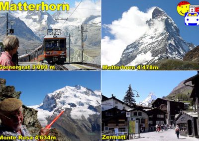
Matterhorn and the mountains of Zermatt
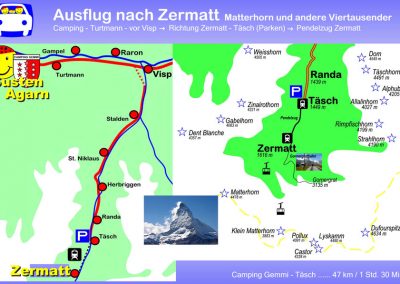
Zermatt is dominated by a wreath of mountain giants that surround it in a wide semicircle and, as the most powerful in Switzerland, are almost all over 4000 m high: the Mischabelhorns (4545 m), the Monte Rosa Group (4634 m), the Zinalrothorn (4221 m), the Weisshorn Group (4505 m) and in the middle between them the mighty Matterhorn (4478 m), also called “Fuji Zermatt”. The most beautiful mountain on earth can best be admired from Zermatt. If you want to be even closer to the mountain giants, take one of the mountain railways, e.g. the GGB, a cog railway that goes up to the Gornergrat (3090m). A financial investment, but also an experience that you will never forget.
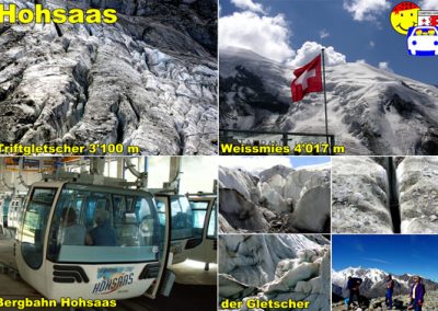
Hohsaas Glacier World in the Saas Valley
The Aletsch Glacier, the largest Alpine glacier, a UNESCO World Heritage Site, is about 24 km long and covers a total area of 120 square kilometers. Riederalp, Bettmeralp and Fiescheralp are car-free locations on a high plateau of around 2000 to 2200 m near the glacier. From there you can reach the best viewpoints with the Hohfluh, Moosfluh, Bettmerhorn and Eggishorn cable cars.
Italy - Ossola, Val Vigezzo, Lago Maggiore
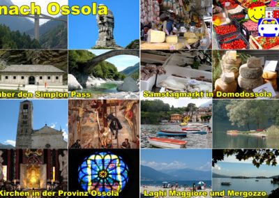
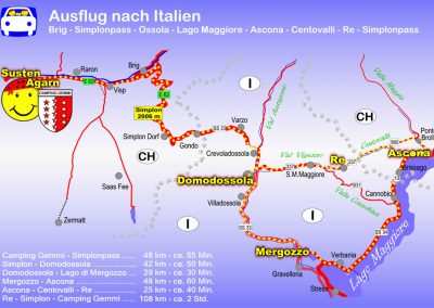
Our tour of the province of Ossola takes us to the Domodossola market on Saturday morning, through the Val Vigezzo to the impressive pilgrimage church of Re, on the winding, narrow road of the Val Cannobina to Lago Maggiore, via Verbania to Lago di Mergozzo and over the Simplon .
Route: from the camping to the east, before Brig over the Simplon pass to Domodossola → on the SS 337 (direction Locarno) to Re → about 5 km back and left to Lake Maggiore, Cannobio, Verbania, Mergozzo → direction Sempione (Simplon), Brig , Visp, for camping
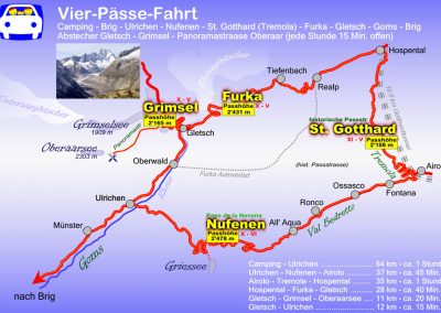
The Furka Pass (2431 m) is the connection from Valais to the Canton of Uri. The pass road begins in Gletsch with a direct view of the Rhone glacier, ice cave on the pass road at the Hotel Belvedere. From the parking spaces on the street you can always enjoy a fantastic view of the valley and the neighboring Grimsel Pass.
The Gotthard Pass (2109 m) has been one of the most important European north-south connections for ages. In addition to the main road, there is still the old post road through the Val Tremola, which we recommend. On partly lovingly restored cobblestones, we admire the old, narrow serpentine road that leads us to Ticino away from the busy main road. You think you are transported to another century, especially when you meet the historic Andermatt-Airolo stagecoach.
The Nufenen Pass (2478 m) is the highest pass in Switzerland and therefore the road is often limited by high snow walls into the summer. The Airolo driveway on a wide concrete slab run leads through the charming Bedretto valley with a wonderful view to the east. We cross the Nufenen on numerous serpentines and come back to Goms in the canton of Valais on a well-developed serpentine road.


